|
|
Site Maps
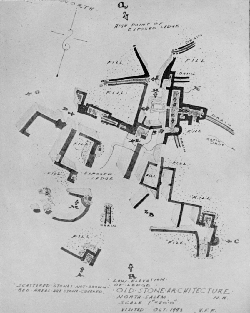
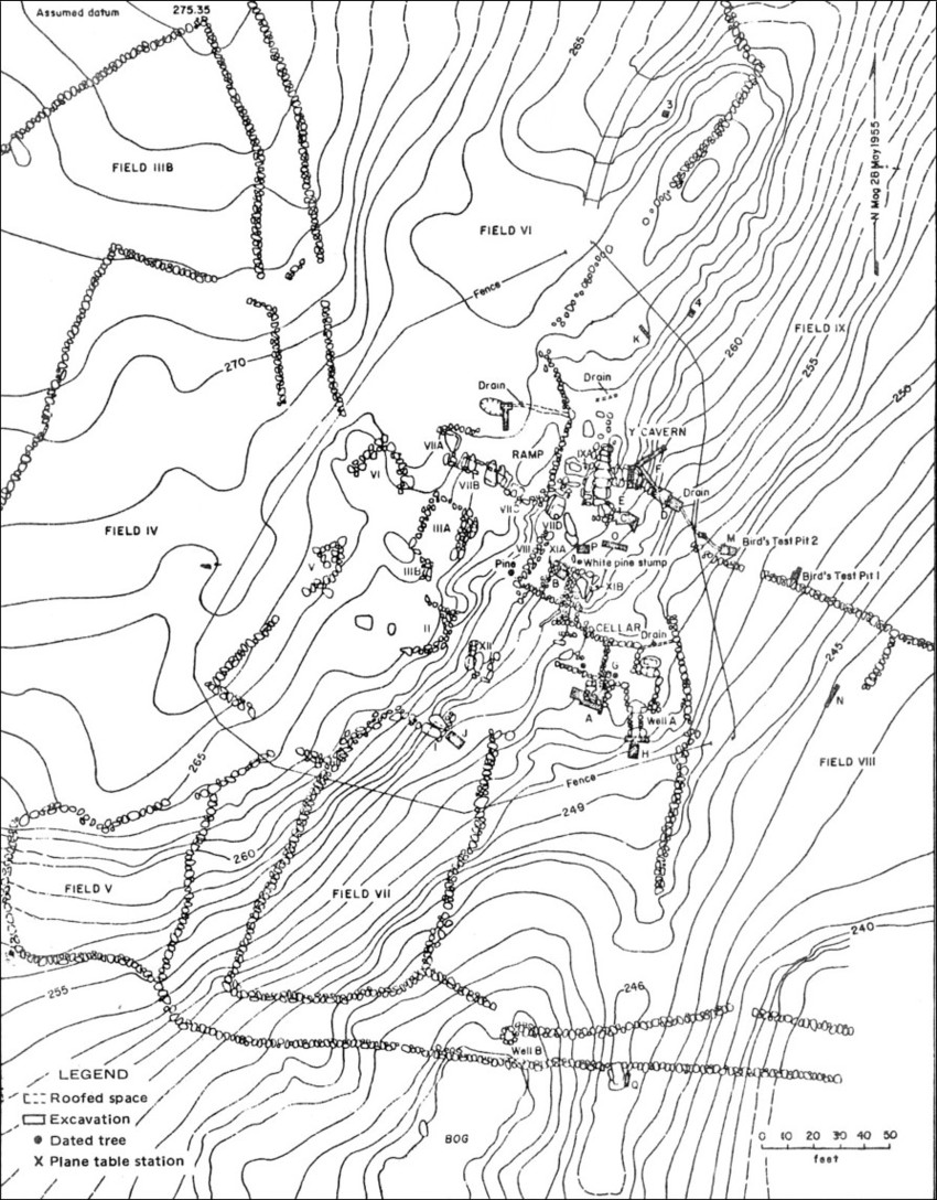
Beginning in the 1930’s, researchers have produced a number of maps of the site. These maps range from simple hand drawn field sketch maps to precision surveys. These maps are an extremely important source of information on the layout of the site, details about the construction of specific structures, and how the site looked prior to various restoration work. Many of these maps, including the transit surveys, contain mistakes or omitted certain details due to human error or the biases of the map’s compiler. It is critical to evaluate each map to determine the reliability of the details shown. This can be done by comparing the maps to each other, to the current site, and to historic descriptions and photographs.
 |
Professor and architect V. F. Fagan’s map of the site was based upon a 1943 field visit to the site. The map shows the location of earthen fill around the site (since removed in some locations) and provides some important details about the East-West Chamber layout. There are a number of mistakes in and around the area of the Collapsed Chamber and therefore this portion of the map needs to treated with great caution. The map appeared in William Goodwin’s book The Ruins of Great Ireland in New England (1946). (Click on photo from higher resolution version).
 |
Archaeologist Gary Vescelius’s 1955 plane table survey map of the site. This map provides a high level detail, elevation data, and the locations of various archaeological excavations. There are a few issue to be aware of. The area to the immediately north of the Large Grooved Stone (i.e. Empty Vessel Chamber) is poorly defined on this map. Another problem is it is difficult to distinguish between exposed bedrock and areas with earthen fill.
Copyright - The copyright status of many of these images (photographs, maps, etc) is not perfectly clear. These images are reproduced on this website strictly for educational and research purposes. If you are the legal copyright holder please contact us at the email address below and we will either add a note indicating the copyright holder or removed the image(s) if there are any objections.


